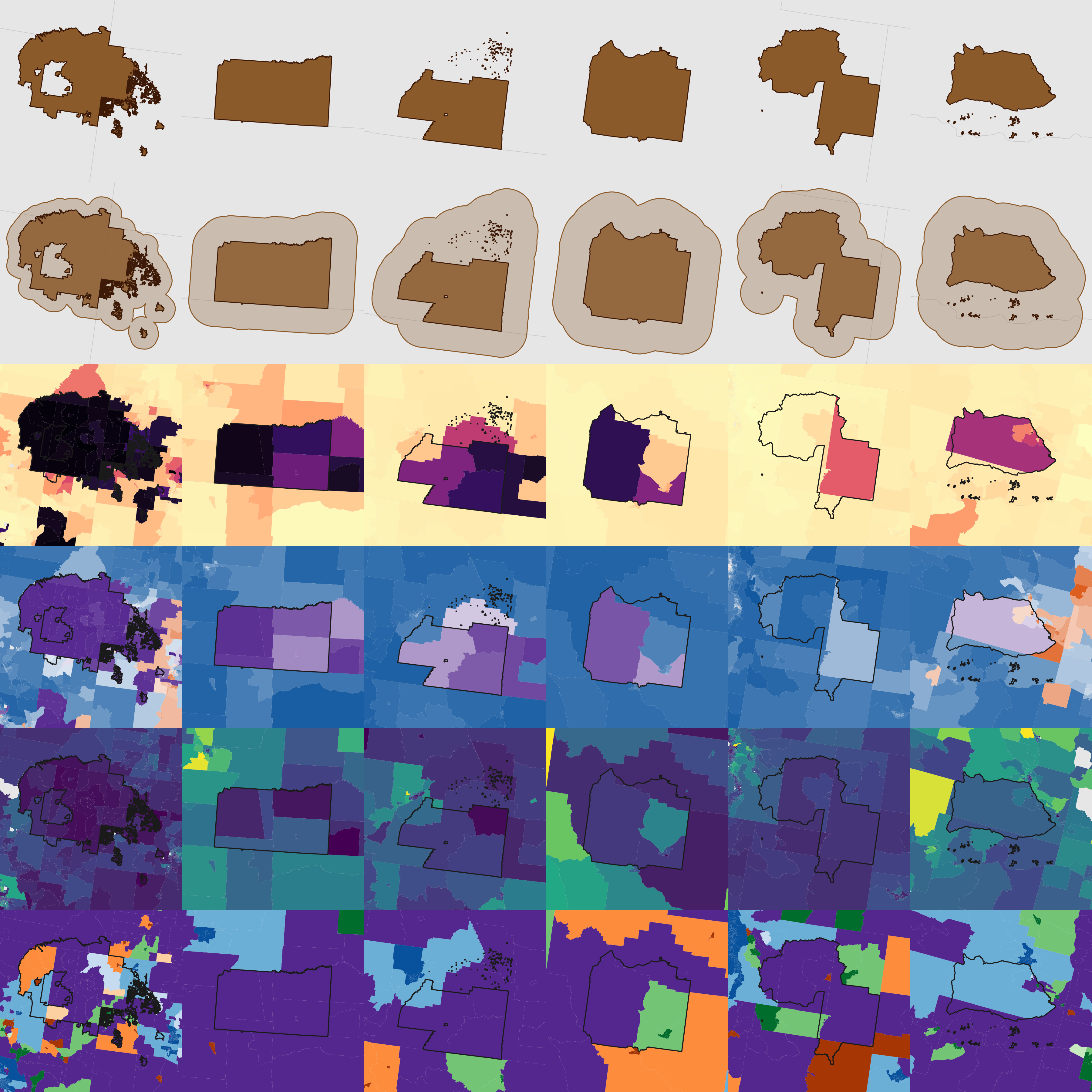
Mapping American Indian Communities
People tend to have a pretty poor understanding of where American Indian and Alaska Native (AIAN) people actually live and what these communities look like. So as part of a bigger project on American Indian communities for First Nations Development Institute with Alex Zhao, I put together a webtool that lets you quickly visualize what these communities look like across the country. Want to see where AIAN people make up most of the population, how rural different reservations are, or how many AIAN people live near a reservation but not on it? This tool is for you.
Under the hood, it pulls Census block data from 2020 and aggregates it up to different geographic levels of interest: tract, place, Native area, metro, or county. Explore it interactively, and download the data from any level for your own use.